Photogrammetry and Aerial Intelligence for Real-World Problems.
We help organizations capture, analyze, and act on high-resolution aerial data—unlocking safer operations, smarter decisions, and breakthrough problem-solving across industries.
Photogrammetry Is the New Ground Truth
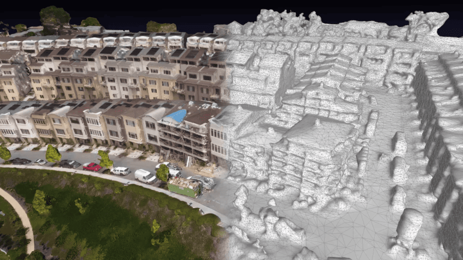
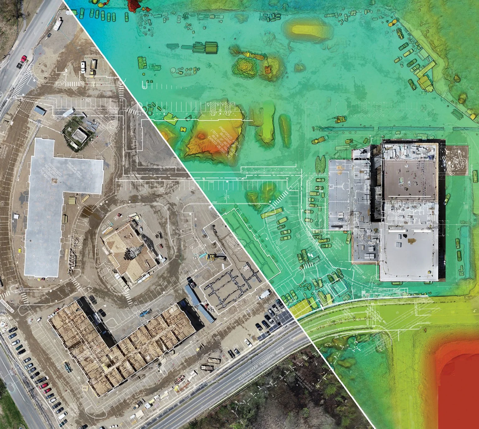
AeroVis delivers high-accuracy photogrammetry using advanced drone systems, industry-leading Pix4D workflows, and expert field operators. We turn thousands of aerial images into measurable 2D/3D insights—helping teams reduce risk, plan with confidence, and accelerate operations.
Whether you need detailed terrain models, infrastructure mapping, construction progress, facility inspection, or large-scale environmental analysis, our photogrammetry workflow gives you the clarity and precision to make data-driven decisions.
Benefits List
Centimeter-level accuracy for mapping and measurement
Fast capture, rapid processing for tight deadlines
High-fidelity 2D orthomosaics and 3D mesh models
Custom deliverables optimized for your industry
Pix4D workflows for premium reconstruction quality
Flexible deployment worldwide
Tailored Aerial Solutions for Critical Sectors
Our team understands the operational reality of the industries we serve. AeroVis builds photogrammetry and aerial intelligence workflows designed to solve problems—not create more work.
-
Real-time situational awareness, terrain models, search & rescue support, and post-incident analysis.
-
Progress documentation, volumetric measurement, site mapping, clash detection, and project forecasting.
-
Crop health imaging, land surveying, irrigation planning, and environmental compliance.
-
Transmission line mapping, solar field modeling, and infrastructure assessment.
Train Your Team. Or Let Ours Handle the Mission.
AeroVis provides end-to-end drone training, flight ops consulting, and outsourced data collection for teams who need accuracy and compliance without the learning curve.
Whether you're building an internal drone program or rely on external operators, we deliver:
Features
FAA-focused operational training
Flight planning for photogrammetry
Safety & risk mitigation protocols
Outsourced mission execution
Processing & deliverables
Precision workflows built on Pix4D

Our Mission
Not Hobbyists. Aviation Professionals.
Veteran-owned, aviation-rooted expertise
FAA-certified and compliant, ready for complex operations
Structured for rapid deployment, not part-time work
Focused on precision, reliability, and results
At AeroVis, drone operations aren’t a side hustle — they’re our profession. Our team brings decades of aviation experience into every mission, ensuring disciplined execution and dependable outcomes.
Ready to See the Field from a New Perspective?
Let’s talk. Book a free, no-pressure consultation to discover how AeroVis can help you save time, reduce costs, and gain real insights with drone technology.